As already explained, Kim Jong Un has approved an attack plan on targets located in the Pacific and mainland U.S. following the yesterday long range round robin mission over South Korea.
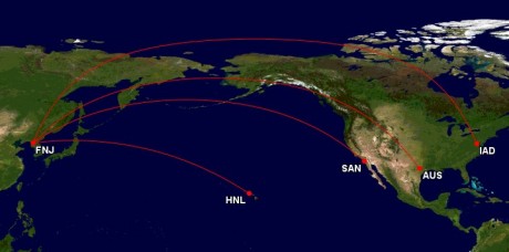
Photos published in KCNA state agency allegedly show the places threatened by the “U.S. Mainland Strike Plan”: San Diego, Washington DC, Austin and Honolulu.
Among the various reasons to doubt about North Korea’s capability to hit Continental U.S. with ballistic missiles, there is also the map deliberately exposed by the images of Kim Jon Un meeting with his military aides on Mar. 29.
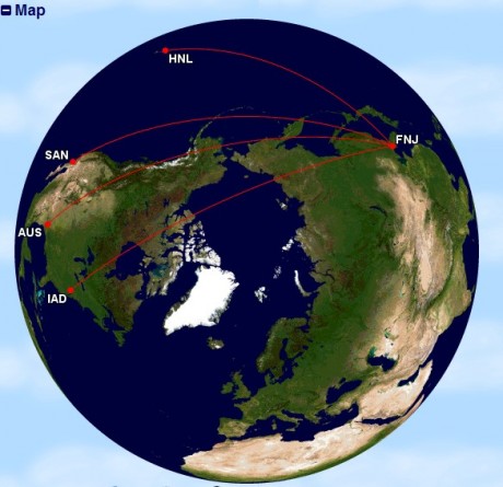
Indeed, Pyongyang’s missiles would find it extremely difficult to reach their intended targets following the path drawn on that map, instead of a great circle route.
A great circle is the shortest path interconnecting two points on a sphere.
Since Earth is almost spherical, routes followed by aircraft (or ballistic missiles…) follow great circles between departure and destination (in case of commercial planes route depends also on ATC restrictions, diplomatic clearances required to overfly particular countries, the strong effect of the wind etc).
The following maps would have been a bit more credible.
Images generated with Great Circle Mapper. Top image credit: KCNA via Business Insider
Related articles


