During the last month, I’ve often thought about the accident I witnessed on Jun. 1 when a brand new NH90 of the Italian Army, piloted by an experienced crew, crashed into the Bracciano lake (for more details visit the following page: NH90 crash pictures. I’ve recollected the moments preceeding the crash many times and each time I’ve discussed with other pilots and journalists about the possible root causes of the crash someone has pointed to the visual illusion caused by the glassy water of the lake.
The surface of the water can be deceiving and for this reason hydroplane student pilots are given a special training on the landing techniques of a floating plane. Spatial disorientation is a risk when flying on the water, because it is similar as flying above a mirror. Under such conditions, estimating height from the water and distances is impossibile. Just think how dangerous could be trying to land on a lake without being able to judge the height from touchdown. Performing a flare too early could result in a heavy impact with the water, while failing to flare in time would be even worse as the float tips would flip the airplane inverted. That’s why pilots operating on a lake should land using a distant horizon as reference, flare at a preplanned altitude and possibly watch the shoreline without looking down until the floats are on the water.
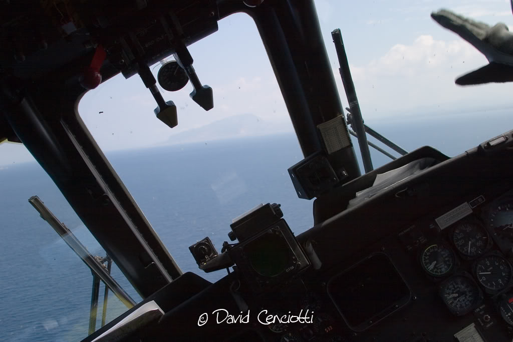
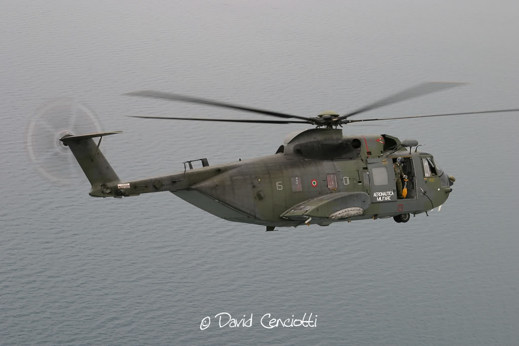
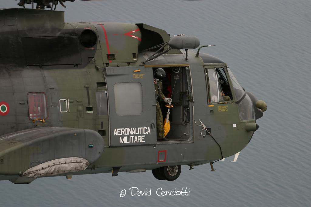
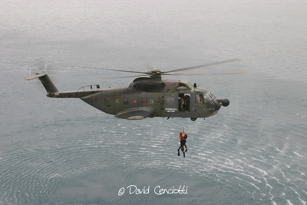
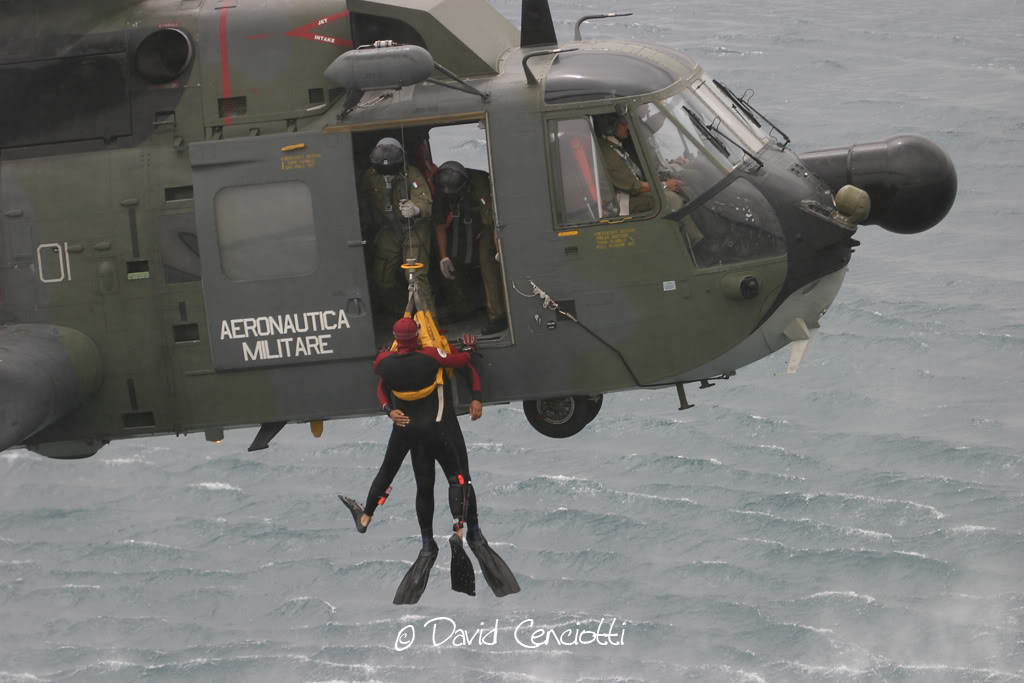
I’ve often flown above the sea, both during daylight conditions and at night. During daylight operations, unless weather conditions are poor (low ceiling, fog and bad visibility) the horizon is almost always clearly visible. Obviously this doesn’t mean that maneuvering at low level is simple! It requires concentration and CRM since reaction time is limited and there’s no much space for corrections or recovery should the need arise. I’ve recently flown with the HH-3F in a low level flight above the sea, performing instrumental approaches to the hovering point to simulate the recovery of a survivor using the hoist. Even if the weather was fine, all the crew had to cooperate in order to perform the preplanned mission and to fly safely the heavy helicopter at low level.
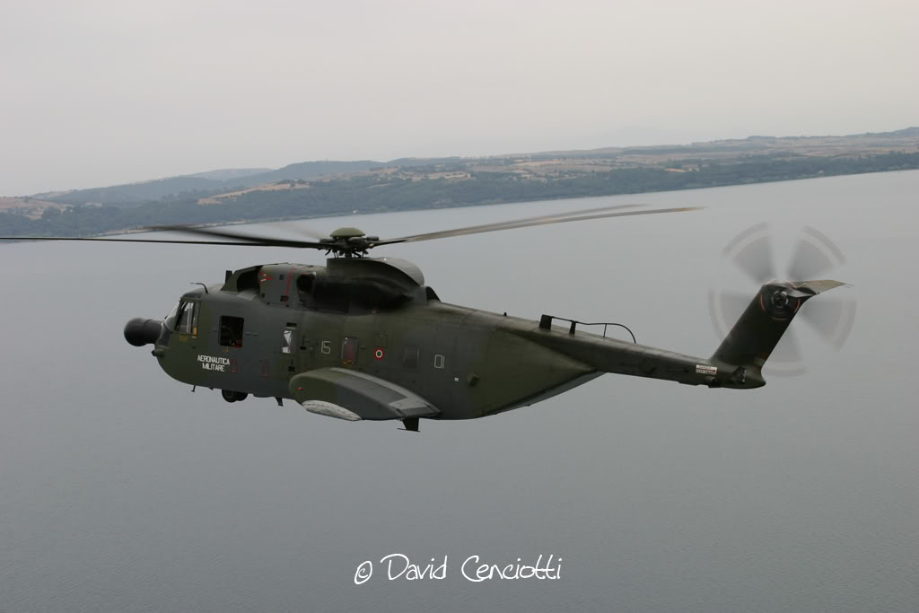
The following pictures were taken during the low level flight above the sea with an HH-3F of the 82° CSAR
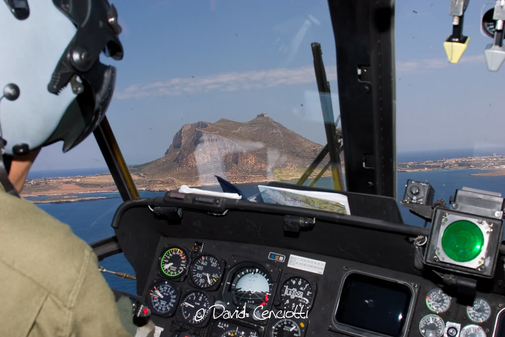
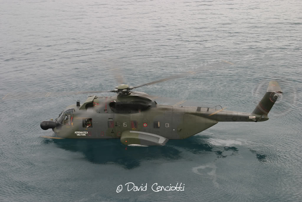
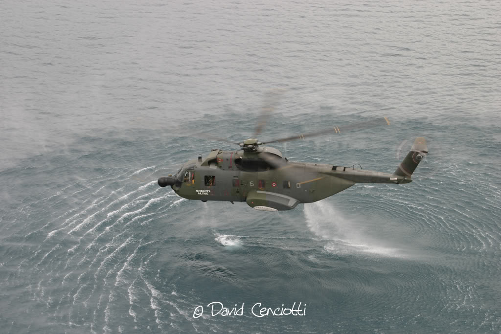
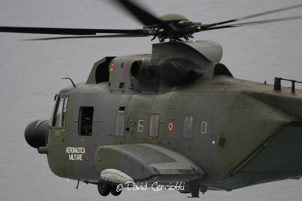
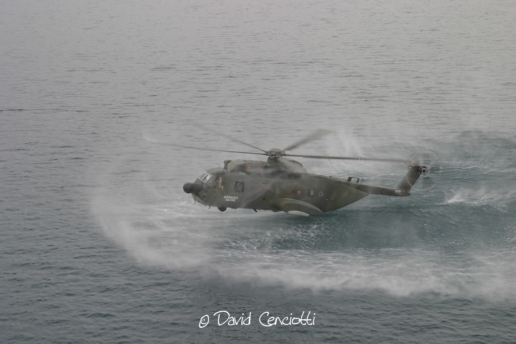
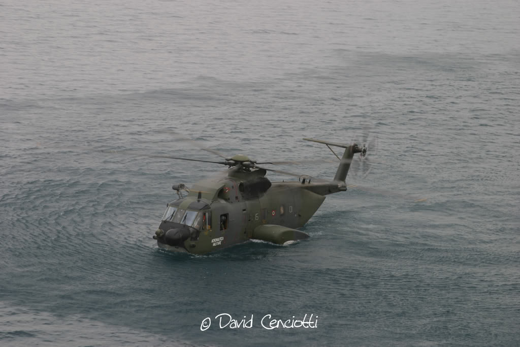
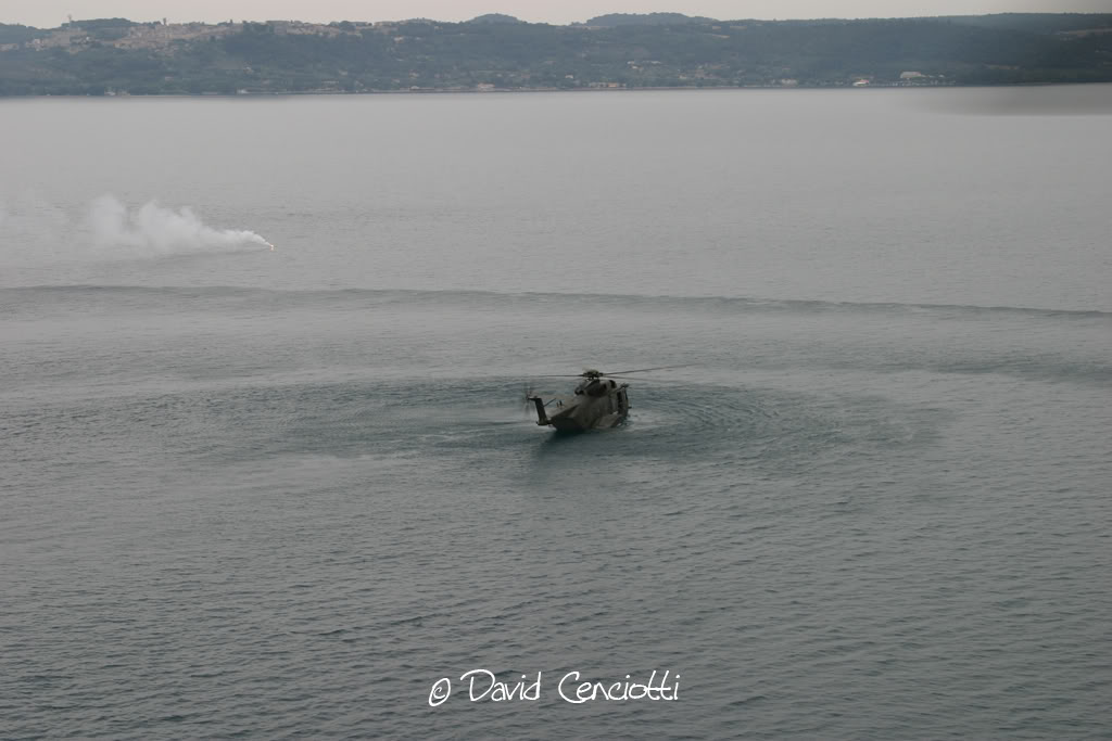
Once I flew above the Bracciano lake with two HH-3F. The weather was poor and the surface of lake was of a disturbing grey. I took pictures of the other Pelican and noticed that when I concetrated on the other aircraft it was extremely difficult to estimate the altitude from the surface of the lake.
The following pictures were taken during the flight above the Bracciano lake with 2 HH-3F of the 85° CSAR and are useful to understand the differences between the sea and lake surfaces


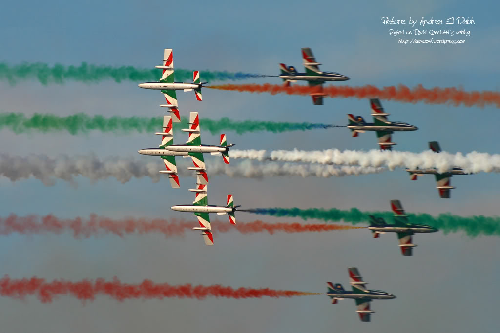
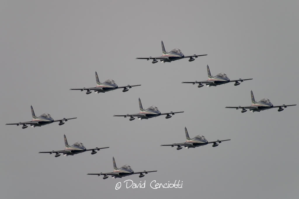
If flying “normally” could be dangerous, just think about the experience, skill and concentration required to perform aerobatic maneuvers above the water. I’ve discussed about the difficulties of a display above the waters with a friend of mine who’s a former F-104 and F-16 pilot and who’s currently flying in the Frecce Tricolori display team: Lt. Piercarlo Ciacchi, “Pony 3”. I met him during the last Giornata Azzurra, the ItAF Open Day held in Pratica di Mare airbase last May. He reminded me that initially, the air displays of the Frecce Tricolori took place only above the ground. The Frecce air display is performed by 10 aircraft (9 + 1 solo) and requires fixed reference points on the ground. In order to orientate above each airport they visit during the airshow season, the Frecce pilots project on a map of the airport the reference point they use at their homebase Rivolto. For this reason, if you hear their comms on the UHF frequency used for the display you’ll hear them referring to “Codroipo”, “Udine”, “Mortegliano” even if there are no such villages nearby: those are the villages located around Rivolto. That said, performing a display above the ground is quite easy, since you can use road, fields, rivers and railways to orientate. During the last decades the Frecce Tricolori began performing their display program above the sea, in front of the coastline. The trick was to use some floating reference points. Maneuvering above the sea during a “coastline airshow” could be even easier than performing above the ground. The main advantage is that….there are usually less obstacles. Main disadvantes are that landmarks are useful to estimate speed, heigh and distances, and improve pilot’s periferic vision and the sun’s reflection on the sea is very strong and flying facing the sunlight could be difficult in certain conditions. Even for this reason, the Frecce usually perform their display at particular hours of the day.
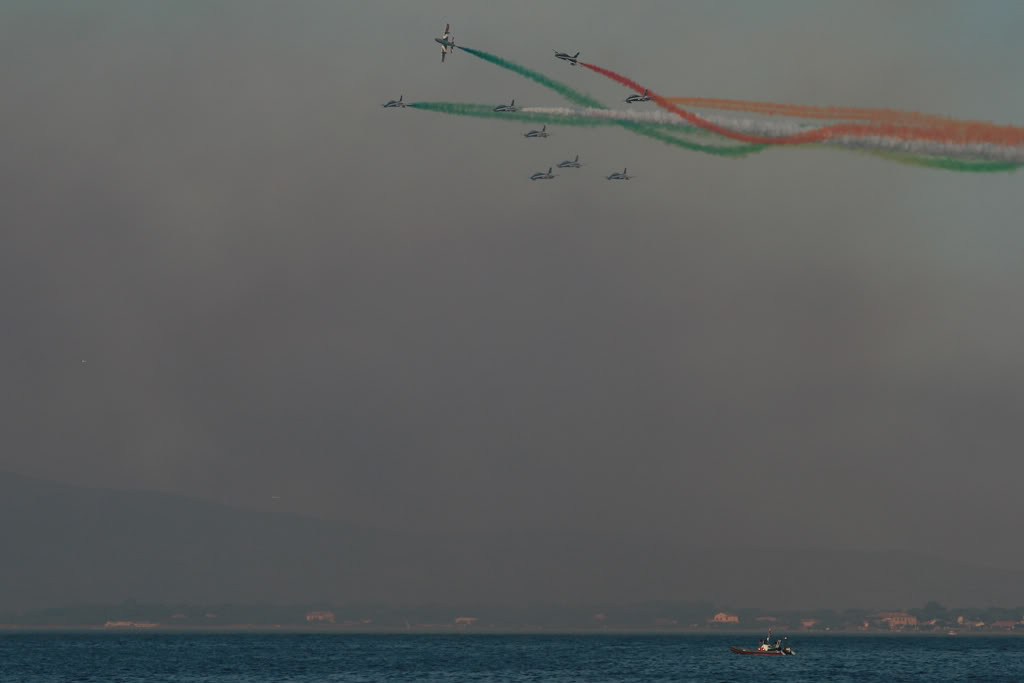
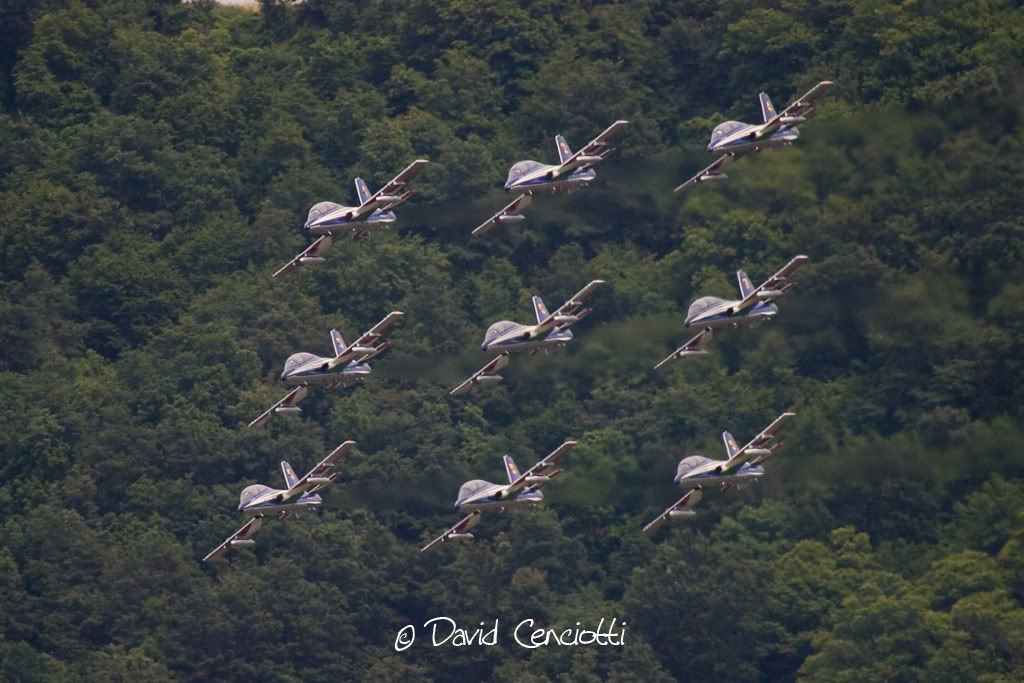
One could think that flying above the lake is similar. It is more difficult. There are strict restrictions for airshows above lakes: because of a different saltiness, the lack of waves and different bed, the surface of the lake usually looks like a mirror. As said, this means that estimating distances is virtually impossibile. Reflection of the surrounding landscape is even worse and spatial disorientation could occur. Airshows on the lake are planned with much more attention than “normal” ones. Furthermore, volcanic lakes (like Bracciano Lake) are often small and surrounded by prominent orography which cause turbolence (I remember my Instructor Pilot who always told me to keep my Cessna 152 away from Bracciano because of the turbolence downwind the hills surrounding the Lake). This explains why on Jun 1, minutes before the NH90 crashed into the lake, the Frecce made only a few flypasts and did not perform their display during “Ali sul Lago” airshow.
The following pictures were taken during those flypasts.


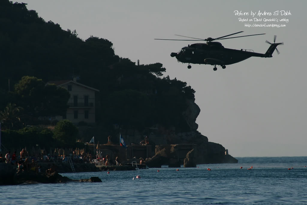
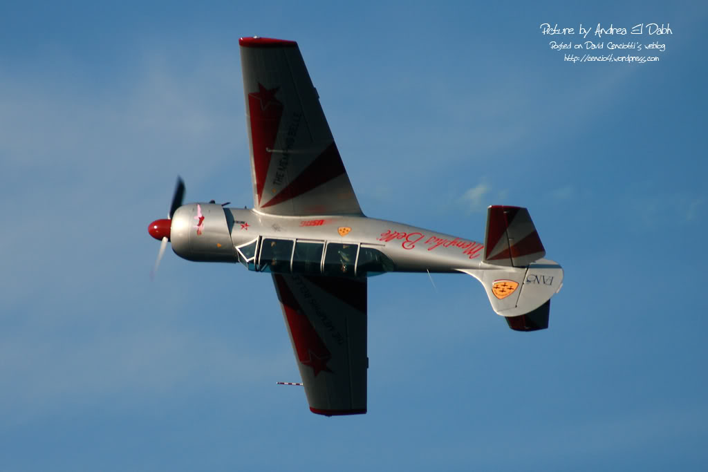
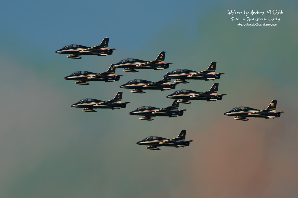
On Aug. 31, Porto S. Stefano (a small village located on the North side of the Monte Argentario peninsula, some 35 km to the S. of Grosseto) hosted a small airshow attended by the Frecce Tricolori, by an HH-3F belonging to the 15° Stormo, a T-6 Texan and the Yakitalia display team. Andrea El Dabh, attended the show and took the following pictures of the air display. Even if pictures were taken in a sunny day while those taken at Bracciano were taken in a cloudy one with overcast ceiling, they are interesting because they permit to compare the different conditions of the water between the sea and a lake.