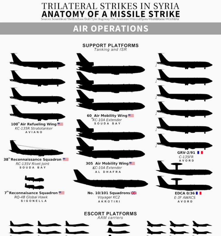
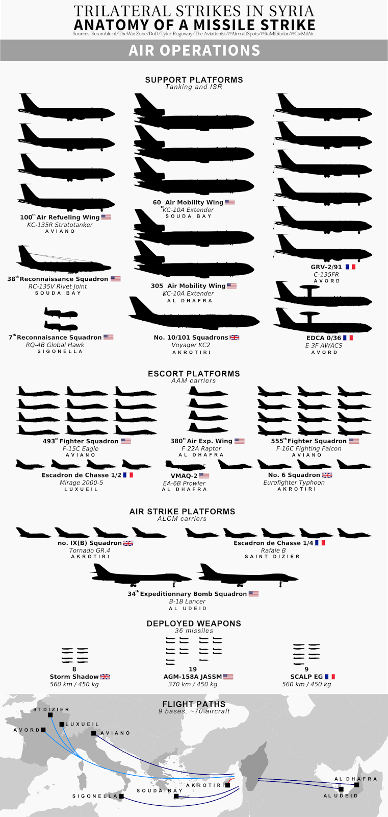
This revised chart provides a good overview of the assets that took part in the Trilateral strikes on Syria last month.
As our readers already know, in the night between Apr. 13 and 14 the U.S., UK and France launched air strikes against Syria. By means of an OSINT analysis, we were able to determine the presence of most of the aircraft which took part in the operation, most of those could be tracked online via information in the public domain, hours before their involvement was officially confirmed.
Based on the “picture” we have contributed to build up, the popular one-man site CIGeography has prepared an interesting chart to visualize the type and number of the assets that have taken part or supported the strike. Although this is a revised version of an original chart posted on Apr. 29, it still contains some inaccuracies: for instance, just 6 out of 8 French C-135FR tankers are shows; at least 11 US tankers supported the American aircraft at various times; two RQ-4s are shown in the chart although we have tracked just one example [#10-2043 – a serial that is still subject to debate] and no other Global Hawk is known to have been committed, etc. Moreover, little is known about the aircraft that operated from the UAE and Qatar bases (including the EA-6B Prowlers, known to have supported the B-1s) and whose presence and number could not be determined by means of online flight tracking; still, it represents the only available chart that summarizes the types, the airbases and the weapons used to attack Syria last month.
Make sure you follow @CIGeography on Twitter and Facebook. You can also buy one of the posters based on this and other charts CIGeography has produced here.


