
Eight days since the Malaysian Airlines flight MH370 disappeared somewhere over southeast Asia, the last known details about the missing Boeing 777 come from the onboard SATCOM system.
Very few details about the MH370 flight from Kuala Lumpur to Beijing, disappered from the skies on Mar. 7, 2014 have emerged. First of all we don’t know if it crashed or landed somewhere. Second, provided it was really hijacked as Malaysian authorities suggest, we don’t really know whether the pilot or co-pilot played an active role in the operation even if investigators are scrutinizing their profile and personal life.
Based on the information that were released so far, we have been able to draw several different scenarios, each featuring a certain degree of likeliness. The few details that were gathered past the loss of radio contact with the aircraft, come from satellites.
Let’s see why.
ACARS
ACARS is the acronym for Aircraft Communications Addressing and Reporting System. It’s an automated communication system used by commercial planes to transmit and receive messages from ground facilities (airline, maintenance department, aircraft or system manufacturer, etc). Therefore, along with the general information about the flight (callsign, speed, altitude, position, etc), these messages may contain what we can consider systems health checks.
ACARS is a service: airlines have to pay for it. According to the information available to date, it looks like Malaysia Airlines subscribed only to engine health monitoring that enabled MH370 to send data to Rolls Royce.
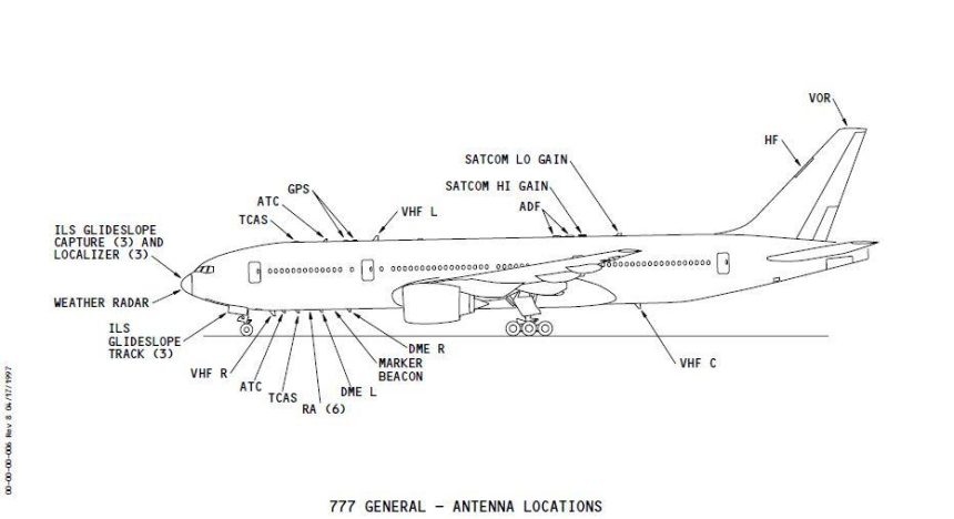
The ACARS system aboard MH370 was switched off some minutes before the transponder.
ACARS rely on VHF frequencies (indeed, you can track planes and decode messages with a simple radio receiver tuned on the proper ACARS frequencies and a software running on your computer) or SATCOM (SATellite COMmunication).
Although this is still debated, according to several pilots the ACARS transmissions can be switched off by the pilot from inside the cockpit, by disabling the use of VHF and SATCOM channels. This means that the system is not completely switched off, but it can’t transmit to the receiving stations.
SATCOM
SATCOM is a radio system that uses a constellation of satellites used to trasmit voice, data or both. As said, ACARS can make use of SATCOM to transmit its data to ground stations. Dealing with ACARS, the SATCOM system used by MH370 was linked to the INMARSAT network.
Inmarsat is a British satellite telecommunications company, which offers global, mobile services through a constellation of three geostationary satellites.
The system relies on “pings”.
Ping
A Ping is a quite common term for IT Networking. It refers to a utility used to test the reachability of a host on an IP network and measure the round-trip time (RTT) of the packets even if it is more frequently associated to the data messages themselves, or “pings”.
Similarly to what happens on a Local Area Network, satellites send pings (once a hour) to their receiving peers that respond to it thus signaling their network presence. Hence, these pings are no more than simple probes used to check the reachability of SATCOM systems aboard the planes.
Based on details recently disclosed, the last response to a satellite ping, was sent by the SATCOM aboard MH370 at 08.11AM Malaysia time, some 7 hours past the loss of contact with the Boeing 777.
From the analysis of the time between request and responce it is possible to work out the distance of the plane which is a circumference of certain radius from the satellite based on which, two possible routes were drawn by the investigators.
The question is why the hijacker(s) did not prevent the plane from responding to pings: most probably, being a networking detail, not even pilots know that their system/antenna respond “I am here” even if the SATCOM is not being used by any onboard systems (i.e. ACARS).
Top image: Boeing; above, Office of the PM of Malaysia
All the articles about MH370 can be read here (scroll down).
I may be missing some important titbit but how does anyone know for certain if the plane turned as a result by the computer? I realize it may have been programmed at any time but why is this so concrete? I understand when it made the turn all communication save data coming from the RR engines was turned off or not functioning. Could someone explain why this is so and what communication system communicated concrete data that the plane was not turned manually. Additionally, I was looking for breadcrumbs in the communications, actions and chain of events especially if the plane was being hijacked or commandeered. Thoughts?
This red herring has now been dismissed in official accounts.
hang on – if the aircraft could give a ‘final’ ping then there were a series of previous pings surely – each with a different response period. This concentric ring data can be mapped and would surely indicate a route or at least a direction – and if various speeds were also input then this would enable the time to get from one ring to another and a set of vectors to be determined?
Is there any other geostationary satellite with an overlapping area that can also have pinged enabling some triangulation here?
I don’t believe that spy satellites and other devices don’t pick up civil pings and the like and could very swiftly answer questions here. Governments are cloaking their real capabilities.
Can they really measure pings that accurately? If the satellite is 22,000 miles up, and the arcs are 2,000 miles from the point beneath the satellite, then trigonometry implies an angle of only 5 degrees and a distance from plane to satellite of about 22,100 miles. But that’s only 0.5% more than the height of the satellite, so if their ping timing was just 0.5% wrong the plane could have been directly underneath the satellite. At 187,000 miles/sec a ping takes 120ms, so a 0.5% error is 0.6 milliseconds. You think their time stamps on pings are that accurate??
All modern satellites have atomic clocks. The accuracy of pings would normally allow them to be accurate to less than 40 nanoseconds (40 billionths of a second). We don’t know the type of ping. If it was a return trip ping then the accuracy would be very high. If its a one way ping from the plane to the satellite then it would rely on the planes internal clock and that could be off. However, if they got a set of pings over a 5-6 hour period, including before the ACARS was turned off, then even f the planes clock was not fully synced it would still be a consistent discrepancy.
I have a very simple question.
Given that the pings were all progressively farther from the satellite according to Inmarsat, how is it possible to get from the last known position/heading to a position on the arc to the South without getting closer to the Satellite?
Sorry all,
I’m just a dumb mathematician. I’m confused that we don’t know more given the quantity of data. Perhaps the best thing is for me to ask some questions … maybe I missed something.
Question 1: I assume the arcs are based on the last ping. But, according to Inmarsat they have 10 satellites in geostationary orbit over the equator at a range of 22,000 miles. Using some simple line of site calculations that means they should have had at least three satellites in range of any ping. Why are they only using the data from one satellite? With three they should be able to get a better idea of exactly where the plane was at the time of the ping? They may not know if it was north or south, but they should be able to get a very accurate position in either of the reflections.
Question 2: We have been led to believe that the pings happened on a regular basis, at one time that was suggested to be once an hour. If that is true we should have a set of data points that combined with the last radar data should given us a set of points. From that, if we assume the plane flew straight between the points, we should have a course and speed. Even if for some reason only one satellite got the ping they would still have multiple points in an arc. Why have we not tried to plot this?
Question 3: How often does a plane ACARS system ping when ACARS is turned off? Or how many ping points do we have and do we know the distance for each ping?
Question 5: Assuming that the answers to questions 1-3 are affirmative, then From that we can calculate the average speed of the plane between the pings, assuming it went in a straight line and from that have a better understanding if the plane was on autopilot or not.
Sorry for long question. But I’m confused as to how we can’t conclude more based on what we have been told. Otherwise something in the data we have been given is untrue.