Lost is an American serial drama series that follows the fate of the survivors of the Oceanic Airlines 815 on a mysterious tropical island located somewhere in the Pacific (even if the serial is filmed mainly in the Hawaii). Departed from Sydney on Sept. 22 2004 at 14:55, from gate 23, and flying to Los Angeles, where it was expected to arrive at 10:42L, the B-777 of Oceanic 815 experienced a radio failure 6 hours after take-off. The pilot decided to land to Nadi airport in the Fiji island (even if the nearest landing field was the Faleolo International Airport in Samoa), but 2 hours later, the plane, flying off-course by approximately 1000 miles, encountered severe CAT (Clear Air Turbolence) and broke-up.
The following compilation from Youtube user battletops provides a view of the plane crash from the passengers’ perspective.
[youtube=http://www.youtube.com/watch?v=ierynZLSLHk]
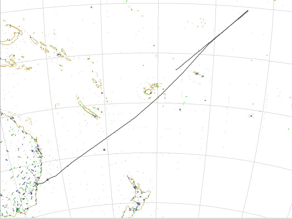
According to the interesting study published on Lostpedia (http://www.lostpedia.com/wiki/Flight_path_of_Oceanic_815) basing on the characters’ statements (failure after 6 hours, turnaround, 2 hours before mid-air break up), the crash location should be somewhere North of Fiji. Actually, Lostpedia based its calculation on a straight route connecting SYD (Kingsford Smith International) to LAX (Los Angeles International) while actual route is most probably sensibly different. In order to discover the actual crash site of OC815 I studied the FPL of a real flight connecting SYD to LAX: QFA 11. I picked the most recent flight plan from FlightAware, dated Sept 27th:
QFA11
Qantas Airways Limited “Qantas” (Australia)
Aircraft Boeing 747-400 (quad-jet) (H/B744/Q)
Origin Sydney Int’l (YSSY)
Destination Los Angeles Intl (KLAX)
Other flights between these airports
Route DIPSO G595 ALLOC KEBAB 3300S 15600E
3200S 15800E 3100S 16000E 2938S 16300E
2600S 17000E 2524S 17103E TERUX 2300S
17500E 1900S 18000E 1355S 17456W 0800S
17000W 0500S 16700W 0300S 16500W 0300N
16000W 0900N 15500W 1500N 15000W 2000N
14500W 2400N 14000W 2700N 13500W 3000N
12500W WEDES B581 FICKY C1177 SXC
Date Thursday, Sep 27, 2007
Duration 12 hours 14 minutes
Status Arrived over 4 hours ago (track log)
Proposed/Assigned Actual/Estimated
Departure 03:25AM GMT 03:35AM GMT
Arrival 08:53AM PDT 08:49AM PDT
Speed Mach .84
Altitude 29000 feet
I plotted the QF11 using FSNavigator and drew the path expected to be flown from Sydney to Los Angeles by Oceanic 815.
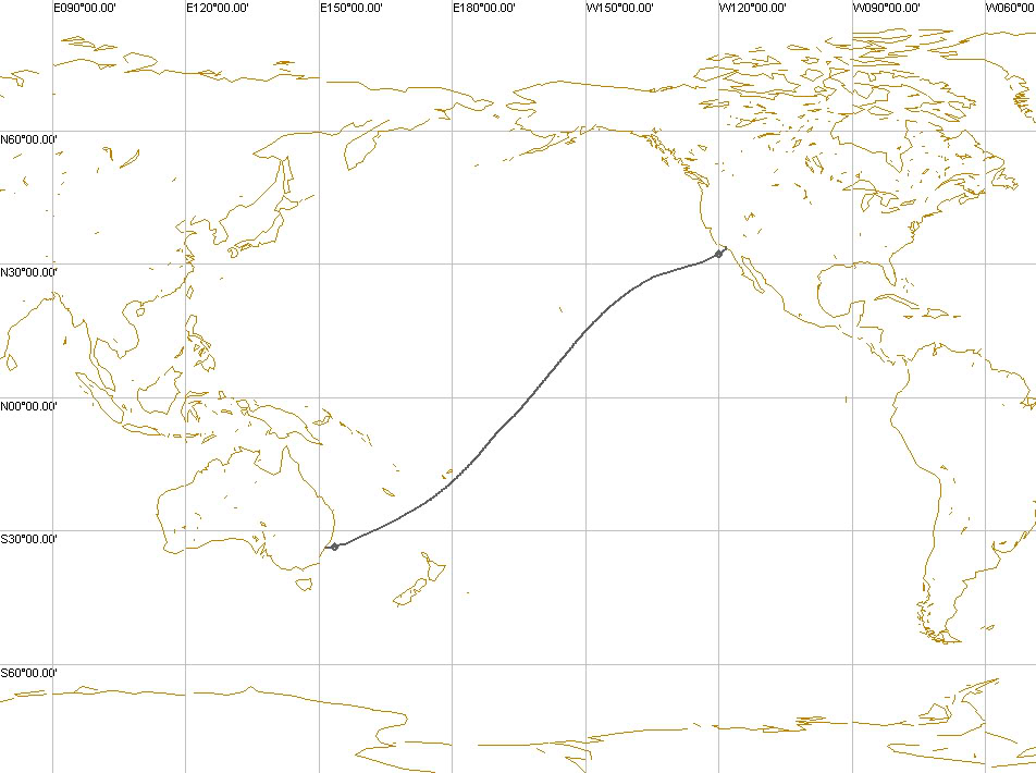
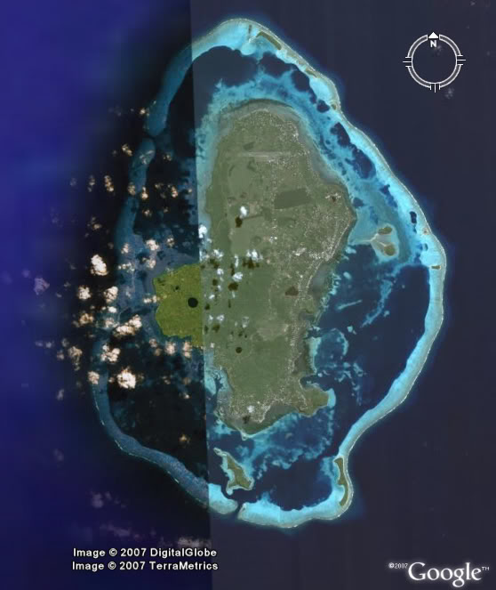
I used a cruising speed of 340KIAS (that I chose to have a total flight time to destination of 12 hours and 14 minutes, the same of QF 11 that on Sep. 28th landed in LAX after 12 hours and 8 minutes), a turnaround point 6 hours after departure, a standard 180° turn, and 2 hours of flight NORDO (No Radio) direct to Nadi International airport and obtained a new crash location 350 Kilometers to the W of Samoa and 600 Kilometers to the North of Fiji; a point that is incredibly coicident with a very small island in the Pacific Ocean whose name is Wallis Island (Uvea). According to my study, that is the exact location of Lost island.

This is the satellite view of Wallis.